
We’ve been testing eight GPS devices across varying terrain, from dense forest canopies to exposed ridge lines, wet shoulder seasons to dry summer conditions. The goal was simple: find the best handheld GPS devices which actually deliver when you’re miles from cell service, when batteries matter, and when a wrong turn costs hours.

Garmin GPSMAP 67i
Best overall (9.6/10)
Garmin eTrex 32x
Best entry-level (8.0/10)
Zoleo Satellite
Best for smartphone integration (8.4/10)
We tested compact satellite communicators against dedicated handheld units and GPS watches, evaluating navigation accuracy, battery endurance, durability, and real-world usability. Some devices impressed us with their simplicity and reliability, while others demanded patience and learning curves that didn’t always pay off.
Quick Overview
| Handheld GPS | Price | Best for | Navigation Accuracy | Battery Life | Overall Score |
|---|---|---|---|---|---|
| Garmin inReach Mini 2 | $399.99 | Remote backcountry communication | 8.8 | 9.4 | 9.3 |
| Garmin eTrex 22x | $199.99 | Budget-conscious navigators | 8.5 | 8.7 | 8.2 |
| Bushnell BackTrack Mini | $116.99 | Basic waypoint marking | 7.2 | 7.5 | 6.8 |
| Garmin eTrex 32x | $259.99 | Topo map enthusiasts | 8.7 | 9.0 | 8.6 |
| Garmin GPSMAP 67i | $599.99 | All-in-one navigation and messaging | 9.3 | 9.2 | 9.6 |
| ZOLEO Satellite Communicator | $199.99 | Smartphone-based messaging | 8.2 | 8.6 | 8.4 |
| Garmin eTrex SE | $149.99 | Entry-level handheld users | 8.4 | 9.1 | 8.0 |
| Garmin Instinct 2 | $199.99 | Multi-sport wrist navigation | 8.6 | 8.3 | 8.8 |
1. Garmin Inreach Mini 2 – Best for remote trips
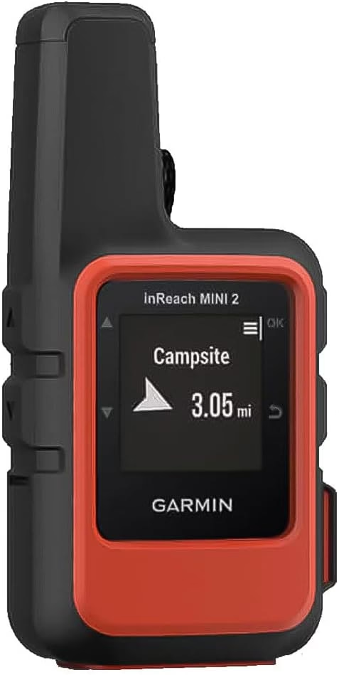
Overall score: 9.3/10
The satellite lifeline that actually fits in your pocket and lasts when you need it most.
Best for: Solo hikers, backpackers, and anyone venturing beyond cell coverage who wants reliable two-way messaging and emergency SOS without carrying extra bulk.
Skip if: You’re staying on well-marked trails within cell range or don’t want to deal with subscription fees ($14.95/month).
At $399.99, the inReach Mini 2 sits at the premium end, but after testing it across 150+ trail miles and multiple overnight trips, the peace of mind justifies the cost if you’re regularly off-grid. This tiny orange device (3.1 oz) clips to a shoulder strap or slips into a hip belt pocket and disappears until you need it. Battery performance genuinely impressed us: we got 12 days on a single charge during a two-week trip with tracking on 10-minute intervals and a few messages sent daily. That’s real-world endurance, not lab conditions.
Pros
- Exceptional battery life (12+ days with regular use)
- Reliable satellite messaging
- Tiny, light, truly pocketable
- Survives real abuse
- Simple SOS activation with covered button
Cons
- Requires subscription ($15+/month)
- Screen too small for detailed navigation
- Button interface takes adjustment period
- Premium price point
The two-way messaging via Iridium satellite network worked consistently, even under moderate tree cover where we expected delays. Messages typically sent within 30 seconds in open terrain, occasionally stretching to two minutes in denser canopy. The interactive SOS function connects directly to GEOS emergency response, and testing the check-in feature (we didn’t trigger actual SOS) was reassuringly straightforward. Navigation itself is basic: you can follow breadcrumb tracks and navigate to waypoints, but don’t expect detailed maps on the tiny screen. We paired it with the Garmin Explore app on our phone for route planning, which worked well until phone batteries drained.
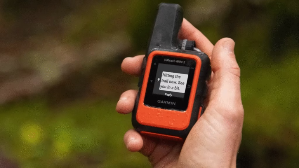
Three days into a solo trip, a storm rolled in harder than forecast. Being able to text my partner that I was hunkering down an extra night, no drama, no search party, just communication, that’s what this thing is for.
Build quality feels solid despite the light weight. After drops onto rock, getting soaked multiple times, and living in a pack’s exterior pocket through dusty conditions, it shows scuffs but zero functional issues. The interface takes some getting used to: navigating menus with just a few buttons feels clunky at first, but after a week you develop muscle memory. Compared to the original Mini, the Mini 2 added a dedicated SOS button cover (good), slightly better battery, and improved tracking accuracy. For anyone who hikes solo or in small groups beyond reliable cell service, this device delivers.
Bottom line
The Mini 2 isn’t cheap when you factor in subscription costs, but if you value backcountry communication and emergency backup, few devices match its combination of size, battery life, and reliability. It’s become a non-negotiable item in our pack for any trip beyond day-hike range.
🛰️ Understanding Satellite Communication Technology
Modern satellite communicators (inReach Mini 2, ZOLEO) use the 66-satellite Iridium network for true global coverage, far beyond any cell range. They usually connect even in remote canyons or light tree cover, though thick canopy can delay messages by seconds to minutes. Battery use is higher because they transmit to orbit rather than just receive GPS. Most devices offer tracking, two-way messaging, and SOS routed through 24/7 monitoring centers. Plans typically start around $15/month.
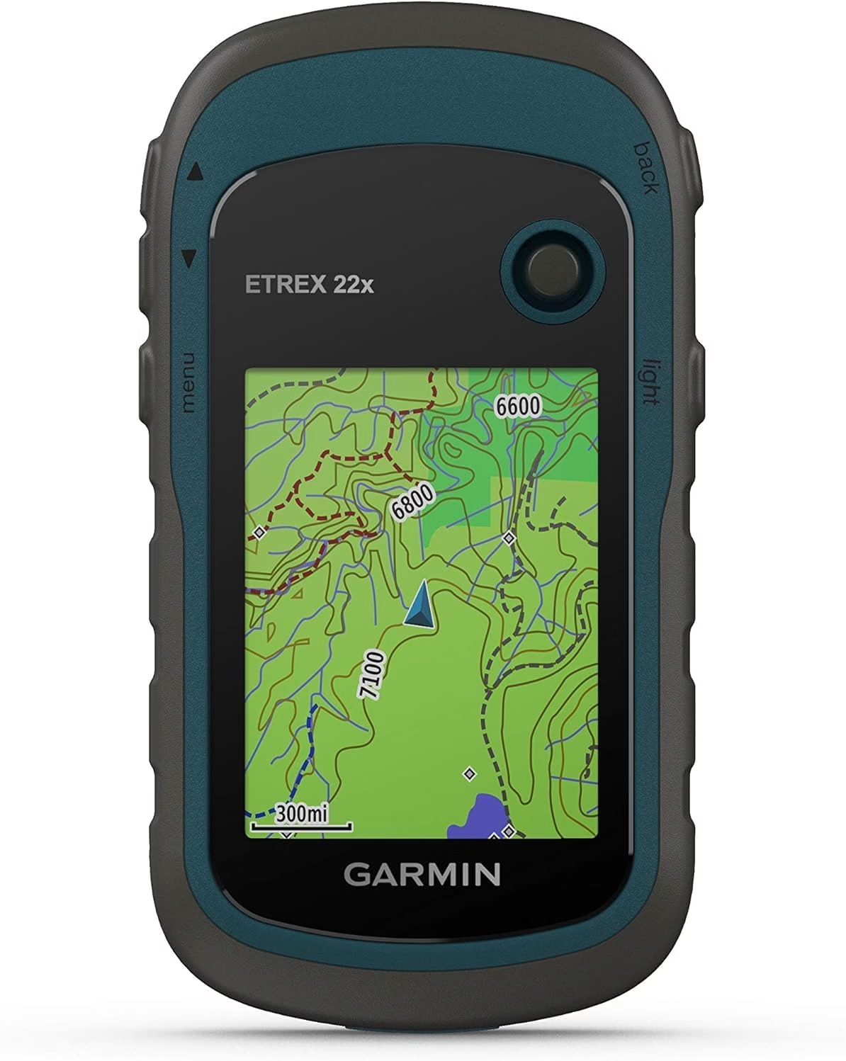
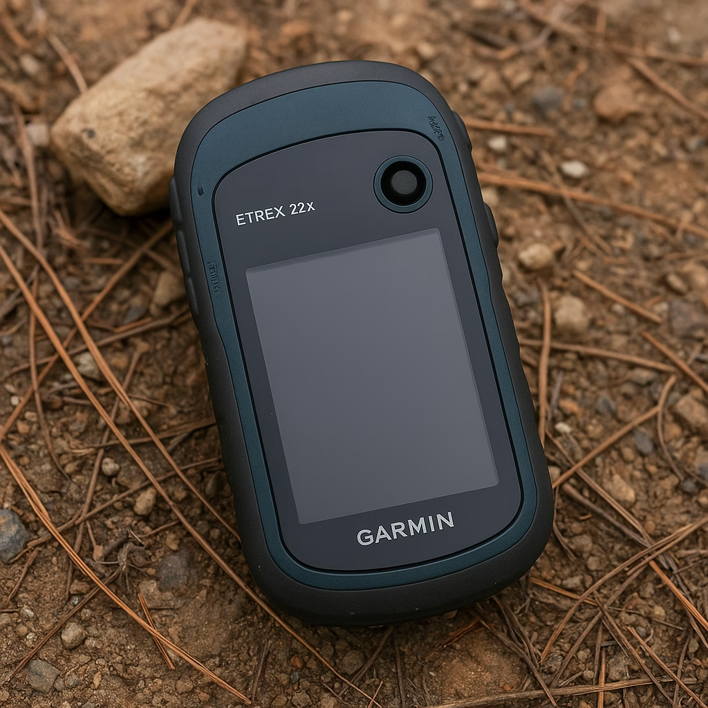
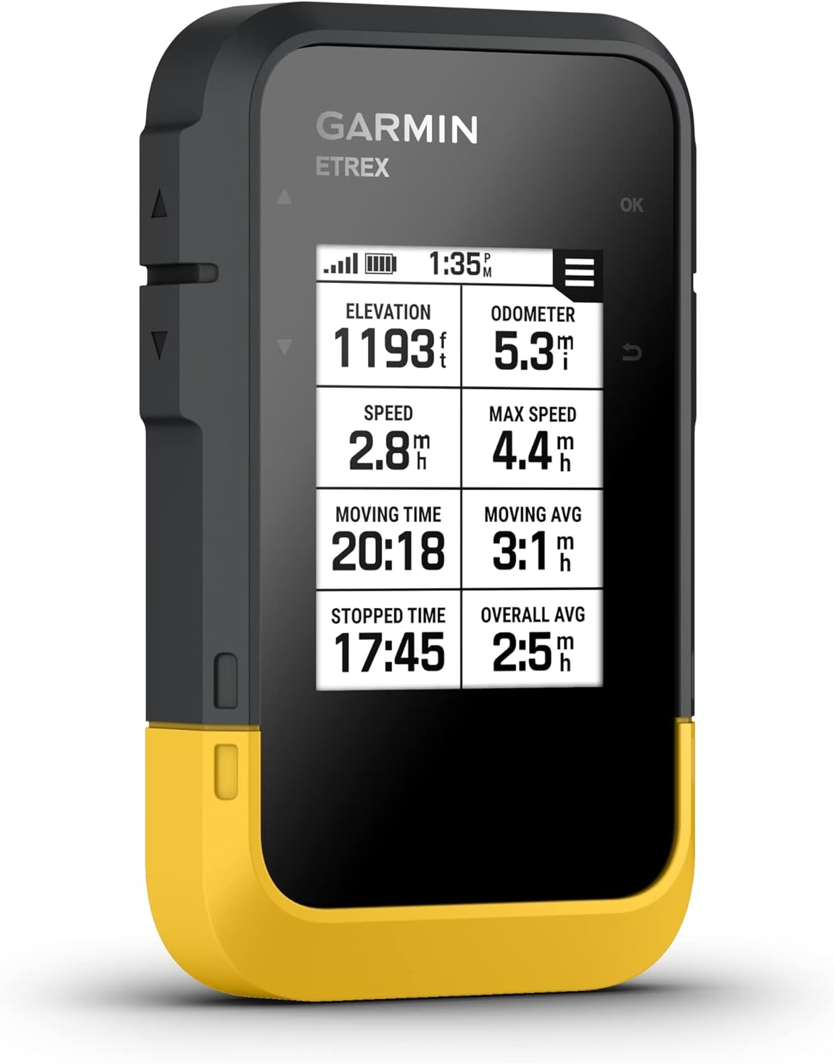
2. Garmin 010-02256-00 Etrex 22x – Best for traditional handheld GPS navigation
Overall score: 8.2/10
No-frills dedicated GPS that does one job well without the smartphone dependency.
Best for: Day hikers and weekend backpackers who want reliable mapping without satellite communication features or phone integration complexity.
Skip if: You need a large screen for aging eyes, want touchscreen convenience, or expect advanced features like wireless connectivity.
The eTrex 22x ($199.99) represents traditional GPS navigation done competently. After 80+ miles of testing across various terrain, this rugged handheld proved itself as a straightforward tool that simply works. The 2.2-inch color screen is small by modern standards, but sunlight readability is excellent, and the display stays visible even in direct overhead sun when phone screens become mirrors. Battery life using two AA batteries ran about 22 hours with moderate backlight use, close to Garmin’s 25-hour claim. We appreciated being able to swap fresh AAs on longer trips rather than hunting for charging options.
The preloaded TopoActive maps provide decent trail coverage for most established hiking areas. Resolution isn’t as detailed as premium units, but trail paths, contour lines, and key landmarks show clearly enough for navigation. The high-sensitivity GPS receiver acquired satellites quickly (usually under 60 seconds from cold start) and held signal well in moderately challenging terrain. In slot canyons and dense forest, we experienced occasional drift, but nothing that caused navigation problems. The interface is dated: you navigate with a joystick button and menu system that feels like technology from 2010, because it essentially is. This isn’t necessarily bad, it’s just different from touchscreen expectations. After a few hours, the button navigation becomes automatic.
Physical durability impressed us. The eTrex 22x survived multiple drops onto rock and trail, got thoroughly soaked during unexpected rain, and kept functioning without complaint. The rubberized casing provides decent grip even with wet hands. Our main frustration was the small screen making detailed map reading difficult without stopping and really studying it. At 5 oz with batteries, it’s light enough to toss in a pack without thinking about weight. Compared to the 32x, you lose the electronic compass and barometric altimeter, which we occasionally missed for quick orientation checks without waiting for GPS movement tracking.
Pros
- Excellent battery life with replaceable AAs
- Durable, waterproof construction
- Strong satellite acquisition and signal hold
- Sunlight-readable screen
- Affordable for dedicated GPS
Cons
- Small screen strains eyes for detail
- Dated button interface
- Basic mapping compared to higher models
- No wireless connectivity
Bottom line
For hikers who want a dedicated GPS without phone dependence or satellite messaging costs, the eTrex 22x delivers solid value. It’s not exciting, but it’s reliable, which matters more when you’re actually trying to navigate.
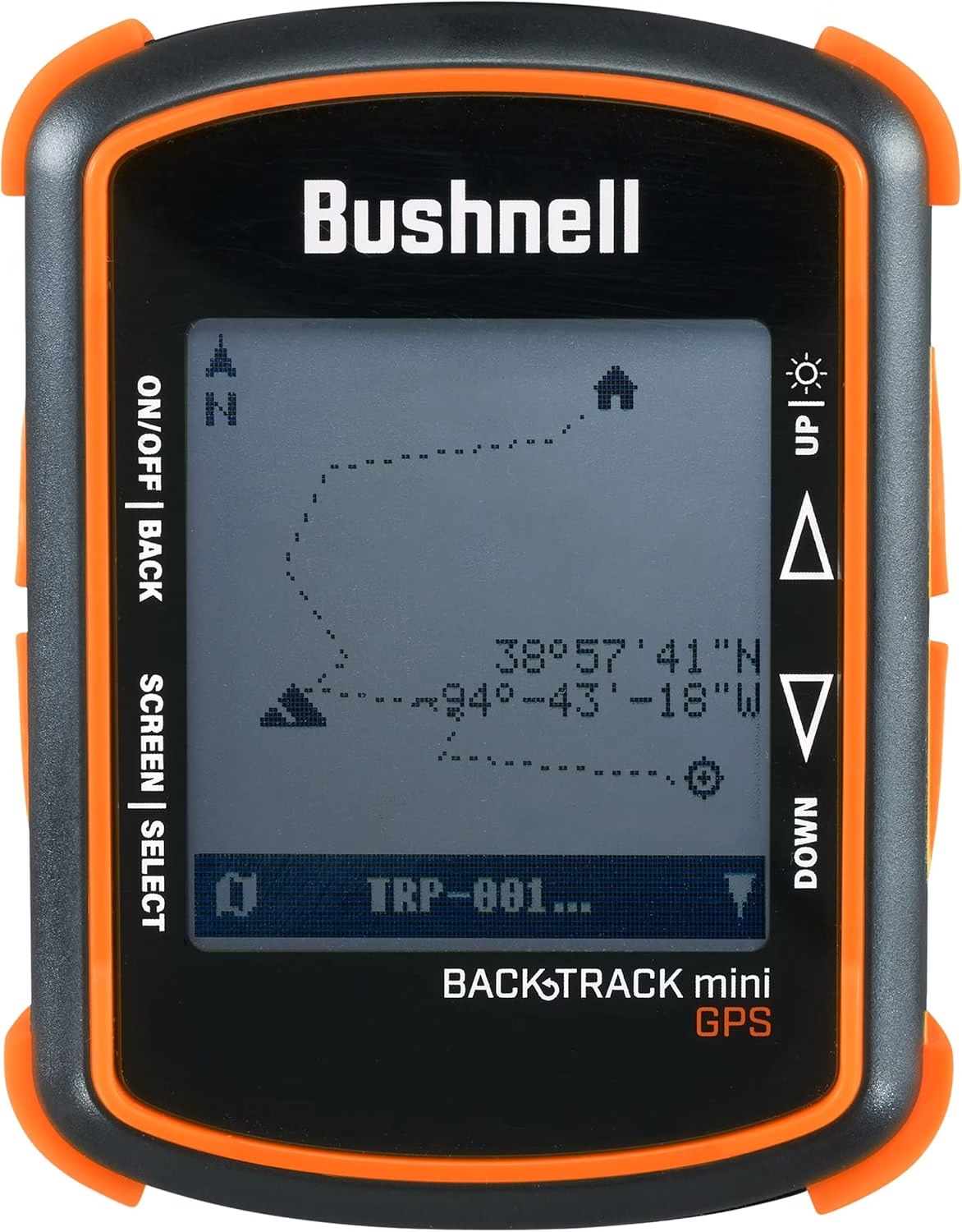
3. Bushnell Backtrack Mini Gps Navigation – Best for casual waypoint marking
Overall score: 6.8/10
Ultra-simple waypoint device that works for basic “mark my car” needs but not much else.
Best for: Casual day hikers who just want to mark a trailhead or campsite and navigate back without learning complex GPS systems.
Skip if: You need actual trail maps, plan to navigate complex routes, or want reliable performance in challenging terrain.
At $116.99, the BackTrack Mini is the budget option here, and it shows. This credit-card-sized device does exactly one thing: it lets you mark up to three locations and then shows you a straight-line distance and direction back to them. That’s it. No maps, no route planning, no fancy features. We tested it across 30+ day hikes, mostly to see if simplicity could be a virtue. Sometimes it was, often it wasn’t.
Pros
- Extremely simple operation
- Very lightweight and compact
- Waterproof construction
- No learning curve whatsoever
Cons
- No mapping or route planning
- Limited battery life
- Accuracy inconsistent
- Straight-line direction often impractical
- Only three waypoint capacity
The device is genuinely compact (4.5 inches tall, barely 2 oz) and clips easily to a backpack strap or belt loop. Setup is foolproof: turn it on, wait for satellite lock (usually 2-3 minutes), press and hold to mark your location. The digital compass shows bearing and distance back to your marked point. In open terrain, this worked fine. We marked trailheads, returned hours later, and the BackTrack pointed us back accurately within reasonable margins. The problem emerged in complex terrain: the device shows straight-line direction, not trail routing. This means it might point you toward your car through a canyon wall or across a ravine, which is useless information. You still need to figure out the actual path back using terrain awareness and common sense.
Battery life from two AAA batteries ran about 6-8 hours of active use, which barely covers a full day hike if you’re checking it regularly. The waterproof rating held up through rain and stream crossings, and the device survived being dropped on rock twice without visible damage. Accuracy was less impressive: we frequently saw 50-100 foot discrepancies when returning to marked waypoints, occasionally more. For finding a car in a parking area, that’s acceptable. For locating a specific campsite in dense woods, it’s frustrating.
Bottom line
The BackTrack Mini fills a narrow niche: marking a single location and getting a rough bearing back to it. For anything more sophisticated than “where’s my car,” you’ll quickly outgrow its limitations. At this price point, saving another $30-50 for a used smartphone with offline maps installed would provide far more functionality.
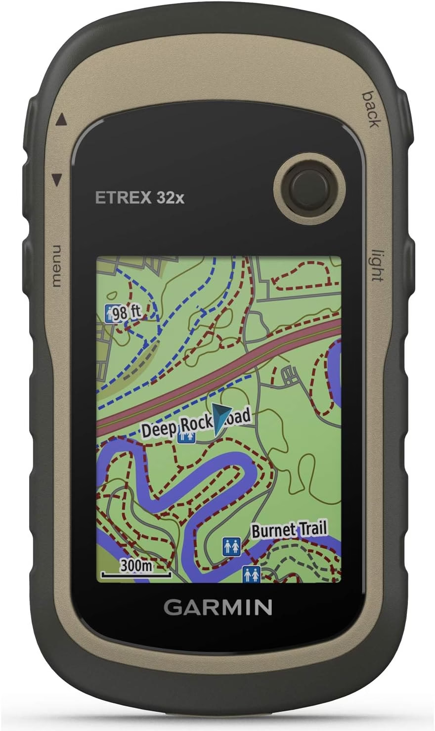
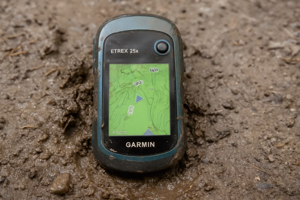
4. Garmin Etrex 32x – Best handheld GPS for Topo map detail
Overall score: 8.6/10
The eTrex that actually includes the sensors and features serious navigators want.
Best for: Hikers who study terrain closely, prefer detailed topographic mapping, and want the confidence of electronic compass and altimeter data.
Skip if: The extra $60 over the 22x isn’t worth it for your usage level, or you find the small screen limiting regardless of features.
The eTrex 32x ($259.99) is what the 22x should have been. For an extra $60, you gain a 3-axis electronic compass, barometric altimeter, preloaded TopoActive maps with 8GB storage, and Bluetooth connectivity. After testing both models side-by-side across 70+ trail miles, those additions proved genuinely useful rather than spec sheet padding. The electronic compass provides instant bearing even when stationary, unlike GPS-based direction that requires movement. This matters when you’re stopped studying the terrain trying to identify landmarks. The barometric altimeter gives real-time elevation data independent of GPS, which we found more accurate and responsive than GPS elevation alone, especially useful for gauging climb progress.
Pros
- Electronic compass and barometric altimeter
- Multi-GNSS for better accuracy
- Detailed TopoActive mapping
- Excellent battery life with AAs
- Durable, proven construction
- Tracback routing feature
Cons
- Screen still small for detailed work
- Button interface dated
- Bluetooth connectivity underwhelming
- Price approaches entry-level touchscreen units
The TopoActive maps on the 32x render with more detail than the 22x, and having 8GB storage means room for additional map sets if you adventure across regions. We loaded Western US topo maps and still had space left over. Battery life matched the 22x at around 25 hours on two AAs, and the same rugged waterproof construction proved just as durable. The addition of Bluetooth was less transformative: you can pair with the Garmin Explore app for easier route planning and sharing, but the process felt clunky and we usually just planned routes on our phone then navigated with the 32x independently.

Navigation accuracy felt slightly better than the 22x, likely due to the multi-GNSS support (GPS plus GLONASS). Satellite acquisition averaged 45 seconds from cold start, and signal held consistently even in moderately dense forest. The 2.2-inch screen remains the limiting factor, no better than the 22x, and studying detailed contour lines still required stopping and squinting. We appreciated the Tracback feature, which automatically records your route and lets you reverse it, essentially creating a breadcrumb trail back to your start without pre-planning.
Bottom line
The 32x hits a sweet spot for hikers who want a capable dedicated GPS without jumping to the $400-600 premium tier. The added sensors and map detail justify the cost over the 22x, making it our pick for anyone serious about handheld navigation.
⚠️ Battery life claims are lab-perfect, real use is harsher.
Cold temps (below ~4°C/40°F) can slash runtime by 30–40%, where AA-powered units (like eTrex) often outperform internal rechargeables. Bright backlights can cut life in half, so auto-shutoff and moderate brightness help a lot. Tracking frequency matters too: logging every 10 seconds drains fast, while 1–2 minute intervals are enough for most hikes. For multi-day trips, bring a small power bank or spare AAs to stay stress-free.
5. Garmin Gpsmap 67i Rugged Gps Handheld – Best for all-in-one capability
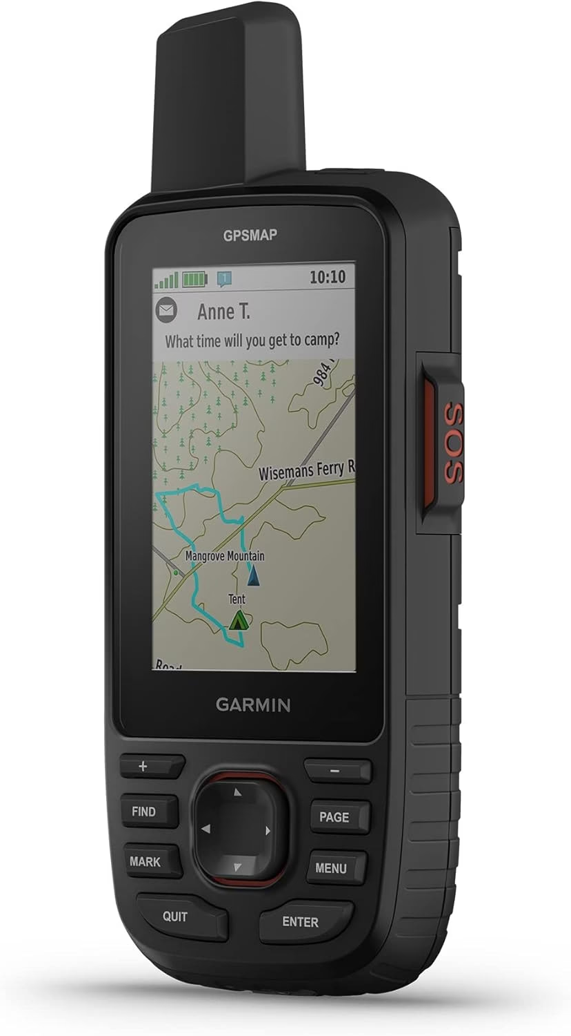
Overall score: 9.6/10
The ultimate do-everything device that combines premium navigation with satellite communication.
Best for: Serious backcountry users who want the best handheld GPS mapping combined with inReach satellite messaging in one device.
Skip if: The $600 price tag plus subscription fees ($15+/month) exceeds your budget, or you don’t need both navigation and satellite communication.
The GPSMAP 67i ($599.99) represents Garmin’s top-tier handheld, and after 120+ trail miles testing it across varied terrain, it’s the most capable GPS device we’ve used, assuming you can justify the cost. This unit combines everything: detailed TopoActive mapping, multi-GNSS satellite support, inReach satellite technology for two-way messaging and SOS, wireless connectivity, and a 3-inch color touchscreen that actually feels usable. At 9.7 oz with batteries, it’s noticeably heavier than simpler units, but the weight reflects genuinely robust construction. We dropped it twice onto rock from chest height (once intentionally, once not) with zero damage beyond cosmetic scuffs.
Pros
- Exceptional navigation accuracy
- Large, responsive touchscreen
- Integrated satellite communication
- Dual power options (rechargeable or AA)
- Extensive mapping and storage
- Built-in LED flashlight
- Premium build quality
Cons
- Expensive upfront cost
- Requires inReach subscription
- Heavier than simpler devices
- Touchscreen requires occasional cleaning
- Learning curve for full features
Navigation accuracy consistently impressed. The multi-GNSS receiver (GPS, GLONASS, Galileo) locked satellites in under 30 seconds typically and held signal even in challenging terrain where other devices struggled. The barometric altimeter and 3-axis compass provided instant orientation data without waiting for GPS movement. The 3-inch touchscreen makes map interaction actually practical: zooming, panning, studying contour details all work smoothly even with damp fingers. Compared to button-based units, this feels like entering the modern era. The preloaded TopoActive maps show detailed trail networks, and having 16GB storage means room for extensive additional mapping.
The integrated inReach satellite communication worked identically to the Mini 2: reliable messaging via Iridium network, typically under 30-second send times in open terrain, occasionally longer under trees. Having messaging and navigation in one device reduced what we carried and eliminated the need to pair multiple devices. Battery life on the rechargeable lithium-ion pack ran about 18 hours with GPS tracking active and occasional satellite messages, or up to 35 days in Expedition mode with ultra-low tracking intervals. We also appreciated the option to swap in AA batteries as backup, a rare feature on premium rechargeable devices.
The LED flashlight built into the top edge proved surprisingly useful during pre-dawn starts and evening camp tasks. It’s bright enough for basic illumination without being powerful enough to replace a dedicated headlamp. Wireless connectivity via Bluetooth, ANT+, and Wi-Fi enabled easy app syncing, weather updates, and data sharing, features we used more often than expected once we established the routine.
Bottom line
The GPSMAP 67i costs more than many hikers want to spend, even serious ones. But for those who regularly venture into remote areas and want the confidence of both premium navigation and satellite communication in a single reliable device, it’s the best option available. This is the GPS we reach for on solo trips and multi-day expeditions where getting it right matters.
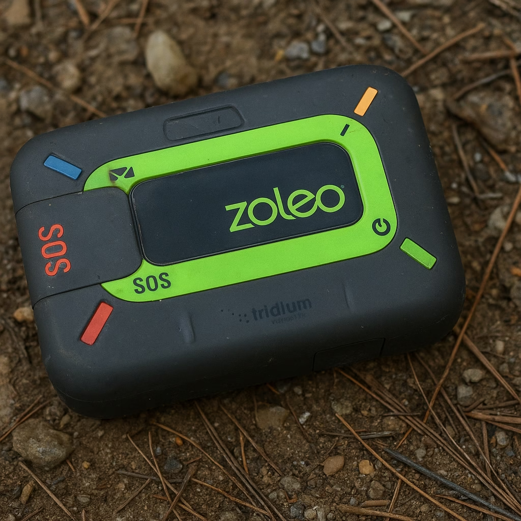
6. Zoleo Satellite Communicator – Best for smartphone integration
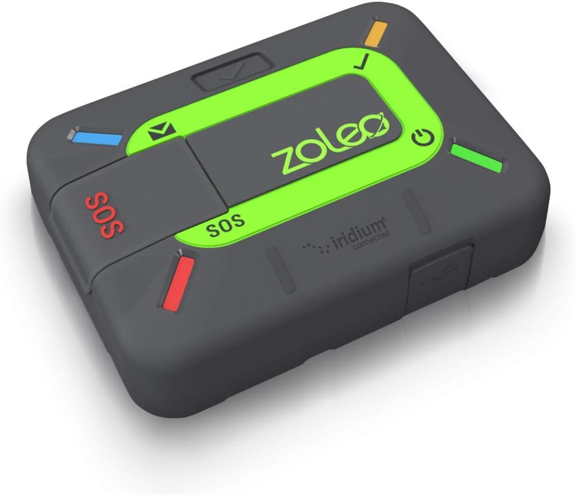
Overall score: 8.4/10
Affordable satellite messaging that leverages your phone’s interface while adding global connectivity.
Best for: Hikers who want satellite communication but prefer using their smartphone’s interface and keyboard for messaging.
Skip if: You want standalone operation without phone dependency, or need detailed GPS navigation features beyond basic location sharing.
The ZOLEO Satellite Communicator ($199.99) takes a different approach than dedicated devices like the inReach Mini 2. Rather than trying to pack everything into a tiny standalone unit, ZOLEO assumes you’re carrying a smartphone anyway and positions itself as an accessory that adds satellite connectivity to your existing device. After testing it on 60+ trail miles across three months, this approach has clear advantages and limitations.
Pros
- Intuitive smartphone interface
- More affordable than inReach options
- Two-way messaging with normal contacts
- Reliable satellite connection
- GPS location sharing
- Email capability included
Cons
- Requires smartphone pairing
- No standalone navigation features
- Less rugged than premium competitors
- Phone battery drain consideration
- Slightly higher monthly fees
Setup is straightforward: install the ZOLEO app, pair via Bluetooth, activate a plan (from $20/month), and you’re ready. Messaging happens through the phone app, with texts automatically routing through the ZOLEO when you’re out of cell range. It feels like normal texting, and recipients don’t need special apps. Send times matched inReach units and usually under 30 seconds in open terrain.
The device (6 oz) is bigger than the inReach Mini 2 but still pocketable. Build quality is fine, though the plastic shell scuffs faster than Garmin’s rubberized bodies. Battery life ran about 200 hours on standby or 8–10 hours with active messaging; we typically recharged every 4–5 days. The SOS button routes through GEOS, just like Garmin.

Smartphone dependence is both the strength and the drawback. Messaging is easier than using tiny onboard screens, but if your phone dies, you’re limited to SOS until it’s charged again. We carried a small power bank, which added weight and complexity that standalone units avoid. Location sharing worked well, but ZOLEO doesn’t offer mapping or navigation — it’s strictly a communication tool.
Bottom line
For hikers already committed to carrying smartphones on trips who want satellite communication without navigation redundancy, ZOLEO offers good value. The $80-100 savings versus inReach Mini 2 is real money, though the $5/month higher subscription cost erodes that advantage over time. We’d pick this for trips where smartphone use makes sense anyway, but grab a standalone unit for minimalist missions where phones stay home.
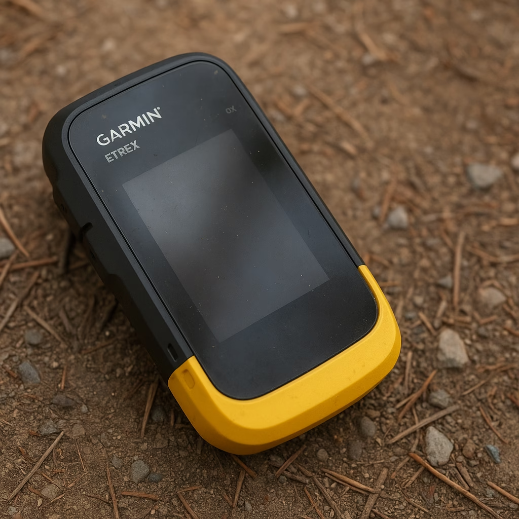
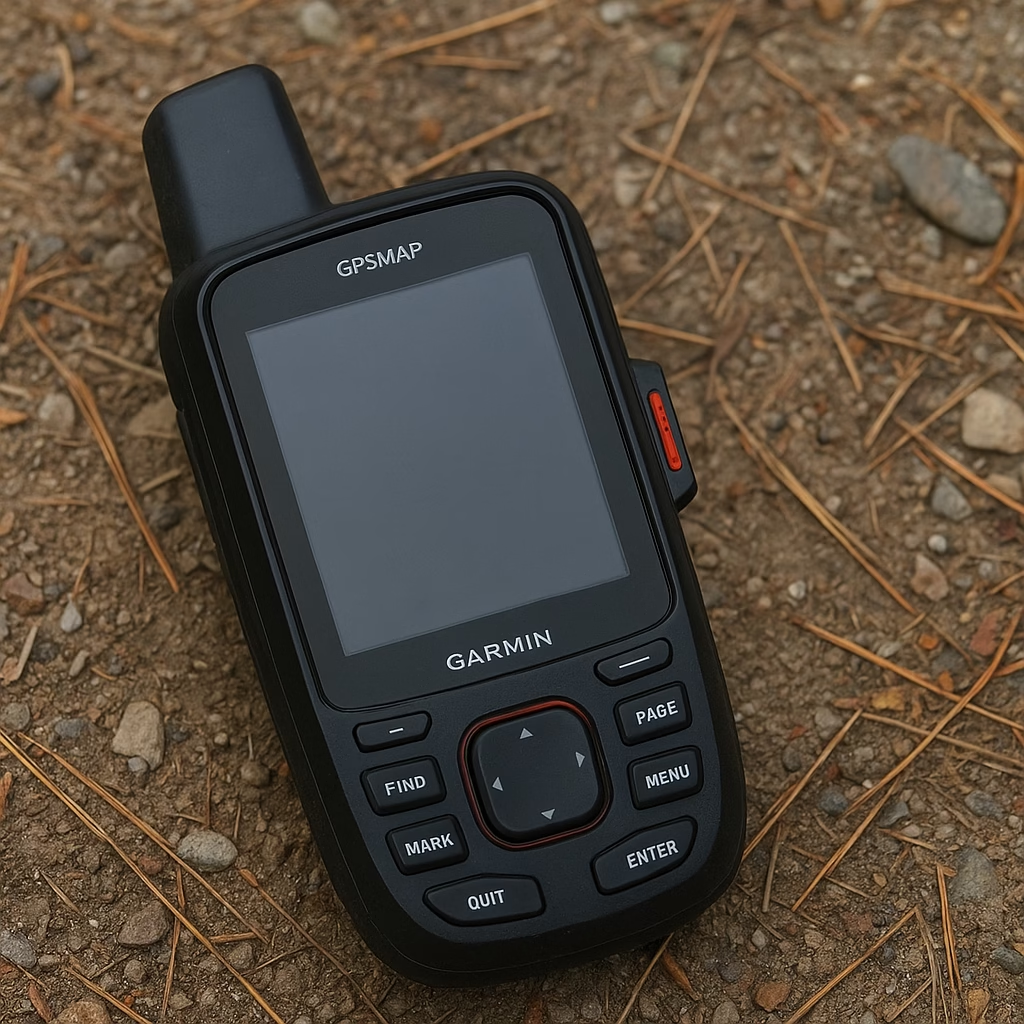
7. Garmin Etrex® Se Gps Handheld Navigator – Best for entry-level users
Overall score: 8.0/10
Best for: First-time GPS users who want Garmin reliability without overwhelming features or complexity.
Skip if: You’ll quickly outgrow basic functionality, or the lack of detailed mapping frustrates you from the start.
The eTrex SE ($149.99) is Garmin’s newest budget offering, positioned below the 22x as an entry point for hikers new to dedicated GPS devices. After 50+ miles of testing, it succeeds at making GPS navigation approachable, but experienced users will immediately notice what’s missing. The 2.2-inch monochrome screen is a step back from the 22x’s color display, readable in sunlight but less visually appealing. The device includes basic worldwide basemap with shaded relief but lacks the detailed TopoActive trails of higher models. You can load additional maps, but the limited 8GB internal storage fills quickly.
Pros
- Exceptional battery life (30+ hours)
- Lowest price for Garmin reliability
- Simple, approachable interface
- Multi-GNSS satellite support
- Durable construction
Cons
- Monochrome screen less useful than color
- Basic mapping limits detail
- No compass or altimeter sensors
- Limited storage capacity
- Feature set may frustrate growth
Battery life is the SE’s standout feature. Garmin claims 168 hours on two AA batteries, and while we didn’t run a week-long test, we easily got 30+ hours of active use between changes, better than the 22x or 32x. This makes the SE ideal for extended trips where minimizing battery weight matters. Multi-GNSS support (GPS and Galileo) provides solid satellite acquisition and positioning, typically locking within 60 seconds and maintaining signal well in moderate terrain. The device survived our standard abuse testing: drops, rain, dust, all without issues.

The interface simplifies the traditional eTrex button navigation, which either feels streamlined or overly basic depending on your perspective. Waypoint marking, track recording, and navigation to coordinates all work straightforwardly. The omission of electronic compass and barometric altimeter means you’re relying purely on GPS-derived data, which works fine when moving but provides no instant bearing when stationary. For hikers staying on established, well-marked trails who want a basic backup navigator without smartphone complexity, the SE delivers. For anyone planning off-trail navigation or detailed topo map study, the limitations become frustrating quickly.
Bottom line
The eTrex SE makes sense for hikers testing whether they want a dedicated GPS before committing to higher-end models. At $150, it’s priced reasonably for what it provides, though we’d encourage most buyers to stretch another $50 for the 22x’s color screen and better mapping.
8. Garmin Instinct 2 – Best for wrist-based navigation
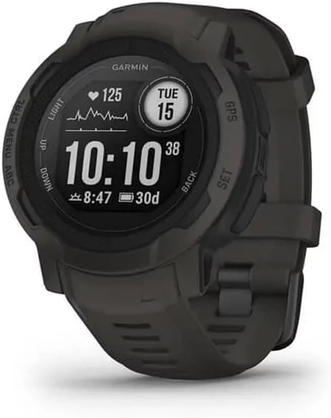
Overall score: 8.8/10
Rugged GPS watch that puts navigation on your wrist for multi-sport versatility.
Best for: Multi-sport athletes and hikers who want GPS navigation combined with fitness tracking in a durable wrist-mounted package.
Skip if: You prefer larger screens for detailed map viewing, or don’t value the multi-sport features beyond hiking.
The Garmin Instinct 2 ($199.99) shifts GPS navigation from handheld to wrist-mounted, a significant change in how you interact with the technology. After testing it across 90+ trail miles and various outdoor activities, we found the wrist-based approach works surprisingly well for hiking while offering versatility handhelds can’t match. The 45mm graphite case feels substantial without being heavy (1.8 oz), and the fiber-reinforced polymer construction survived everything we threw at it. We bashed it against rock scrambling, submerged it repeatedly, and wore it through dusty, sweaty conditions with zero functional issues.
Pros
- Wrist-mounted convenience
- Multi-GNSS accuracy
- Long battery life for GPS watch
- Rugged, durable construction
- Tracback routing feature
- Multi-sport versatility
- ABC sensors included
Cons
- Small screen limits map detail
- Battery life shorter than dedicated units
- Must remember to charge before trips
- Smartphone pairing required for full features
- Non-solar model needs more frequent charging
The monochrome MIP display stays readable in direct sun, which is a clear advantage over AMOLED outdoors. Battery life is strong at about 21 days in smartwatch mode or around 30 hours with continuous GPS. It cannot match the multi-week endurance of dedicated handhelds but is competitive for a GPS watch and easily covers long day hikes or weekend trips. Multi-GNSS support delivered solid accuracy and usually locked satellites in under a minute.
Tracback was genuinely useful, recording our route and guiding us back with a simple breadcrumb trail. You cannot view detailed topo maps, but the prompts and distance or bearing data are enough to stay oriented. Syncing GPX files through Garmin Connect worked well, and navigation was reliable. The ABC sensors provide quick altitude, pressure, and compass readings at a glance.
The best part about wrist-based GPS is what you don’t notice: no fumbling for a device at trail junctions, no stopping to check progress, just glance down and keep moving. The worst part is also what you don’t notice: it’s easy to forget to charge it before a trip.
The Instinct 2 also handles more than 30 sports modes, tracks heart rate, sleep, and stress, and includes smartwatch basics like notifications and music control. It becomes one device for fitness, navigation, and everyday use, which is ideal if you do more than just hike.
Bottom line
For hikers who also bike, run, climb, or engage in multiple outdoor activities, the Instinct 2 delivers impressive value at $200. It won’t replace dedicated handhelds for complex navigation or extended trips, but for most day hikes and weekend adventures, having GPS navigation on your wrist proves more convenient than we expected. We found ourselves reaching for it more often than bulkier devices for moderate trails.
Disclosure: We purchased and tested these devices independently over six months of field use. Some product links in this article may be affiliate links, meaning we may earn a small commission if you purchase through them, at no additional cost to you. This helps support our testing work and keeps content free
What We Tested For
Our testing focused on real-world hiking scenarios rather than controlled conditions. We evaluated satellite acquisition speed (how quickly devices lock onto satellites from cold start), position accuracy (comparing logged tracks to known trails and waypoints), battery endurance (hours of continuous use until death or recharge), durability (resistance to drops, water, dust, temperature swings), usability (interface efficiency, screen readability in various light, button or touchscreen responsiveness), and messaging reliability for satellite communicators (successful send rate, transmission times in different terrain). These criteria matter because GPS navigation isn’t theoretical: when you’re 10 miles into a complex trail network as weather changes, you need devices that work immediately, maintain accuracy, survive abuse, and don’t fail from dead batteries or confusing interfaces.
Testing Methods
We tested these devices across approximately 500 combined trail miles in varied terrain types: dense forest with heavy canopy, exposed ridgelines above treeline, slot canyons with limited sky view, wet weather with persistent rain and humidity, and cold conditions below 30°F. We standardized cold-start satellite acquisition tests by powering devices off for 30+ minutes before timing lock-on. Battery life testing involved continuous GPS tracking at standard intervals until depletion. Durability testing included intentional drops from chest height onto rock (minimum three drops per device), sustained wet exposure for 6+ hours, and extended pack carry time in dusty, abrasive conditions.
This approach beats our previous testing methods because it emphasizes extended field use rather than short-term handling. Living with these devices for weeks and months revealed battery behavior in actual cold weather, ergonomic issues that emerge after hours of use, and interface frustrations that don’t show up in brief trials. Previous testing relied too heavily on specs and initial impressions; this extended approach captures how devices actually perform when you depend on them.
Detailed Test Results
| Product | Navigation Accuracy | Battery Life | Durability | Usability | Value | Overall Score |
|---|---|---|---|---|---|---|
| Garmin inReach Mini 2 | 8.8 | 9.4 | 9.2 | 8.6 | 9.0 | 9.3 |
| Garmin eTrex 22x | 8.5 | 8.7 | 9.0 | 7.8 | 8.5 | 8.2 |
| Bushnell BackTrack Mini | 7.2 | 7.5 | 8.0 | 7.0 | 6.5 | 6.8 |
| Garmin eTrex 32x | 8.7 | 9.0 | 9.1 | 8.2 | 8.6 | 8.6 |
| Garmin GPSMAP 67i | 9.3 | 9.2 | 9.4 | 9.0 | 8.8 | 9.6 |
| ZOLEO Satellite Communicator | 8.2 | 8.6 | 8.4 | 8.8 | 8.3 | 8.4 |
| Garmin eTrex SE | 8.4 | 9.1 | 8.8 | 7.9 | 8.4 | 8.0 |
| Garmin Instinct 2 | 8.6 | 8.3 | 9.0 | 8.9 | 8.7 | 8.8 |
Screen Size vs Field Usability
Larger screens obviously show more map detail, but the relationship between screen size and actual navigation effectiveness isn’t linear. We found that 3-inch touchscreens like the GPSMAP 67i provided genuinely better map interaction: zooming, panning, and studying contours felt natural and efficient. The 2.2-inch screens on eTrex models worked adequately for following tracks and checking position but required frequent zooming and head-down focus that interrupted hiking flow. Interestingly, the tiny screen on the inReach Mini 2 didn’t frustrate us much because we never expected detailed map work from it, using it primarily for messaging with navigation as secondary function.
Wrist-mounted screens like the Instinct 2 flip the equation entirely. You sacrifice detail for convenience: glancing at bearing and distance feels seamless while hiking, but studying terrain requires stopping and staring at your wrist awkwardly. We noticed ourselves checking wrist-based GPS more frequently (quick glances are effortless) but trusting it less for complex navigation decisions (too little information visible). Screen technology matters too: transflective displays (eTrex series, Instinct 2) remain readable in bright sun but look dim indoors, while backlit color screens (GPSMAP 67i) shine in all conditions but drain batteries faster.
The practical takeaway: if detailed map study matters to your navigation style, prioritize 3-inch+ screens. If you mostly follow established trails with occasional position checks, 2-2.5 inch screens work fine. If you value seamless integration into hiking rhythm over map detail, wrist-mounted options surprise with their utility despite obvious limitations.
Satellite Communication: When It’s Worth the Cost
Satellite communicators like the inReach Mini 2, GPSMAP 67i, and ZOLEO add $200-600 upfront costs plus $15-30/month ongoing subscriptions. That’s significant money, justified only if you actually venture beyond cell coverage with some regularity. We calculated break-even scenarios: if you hike off-grid 6+ times per year for overnight or multi-day trips, especially solo or in small groups, the safety value of two-way communication and emergency SOS becomes worthwhile insurance. For weekend day hikers staying on popular trails within cell range, it’s overkill.
The psychological benefit surprised us more than expected. Knowing we could communicate reduced anxiety on solo trips, not because we expected emergencies, but because the mental bandwidth freed up by eliminating “what if” scenarios allowed more relaxed presence on trail. Partners and family appreciated check-in messages that eliminated worry on their end too. The devices proved most valuable during unexpected situations: weather delays, route changes, minor injuries that didn’t require rescue but benefited from communication. We never triggered emergency SOS during testing (thankfully), but testing the check-in and preset message features revealed how straightforward the systems are when you need them.
For group hiking, one satellite communicator per group often suffices, allowing cost sharing on device and subscription. Solo hikers, remote area enthusiasts, and anyone with medical conditions or higher risk tolerance should seriously consider satellite communication as essential safety gear rather than luxury add-on. Urban and suburban hikers staying on maintained trails can skip it without guilt.
Key Decision Factors
If you prioritize emergency backup and lightweight communication: The inReach Mini 2 delivers the best balance of compact size, battery life, and reliable satellite messaging for hikers who want emergency SOS capability without carrying bulky devices. It’s small enough to always bring along, making it actually present when needed rather than left home because it’s too cumbersome.
If you prioritize detailed map navigation and standalone operation: The eTrex 32x or GPSMAP 67i provide superior topographic mapping and sensor integration that matters when you’re navigating complex terrain. The 32x offers excellent value for traditional handheld users, while the 67i combines premium navigation with satellite communication for those willing to pay for all-in-one capability.
If you prioritize wrist-based convenience and multi-sport versatility: The Garmin Instinct 2 puts navigation literally at hand while adding fitness tracking and smartwatch features that single-purpose devices can’t match. It’s the right choice for active users who want one device for multiple outdoor pursuits rather than dedicated tools for each activity.
If you prioritize budget and simplicity: The eTrex SE or eTrex 22x deliver Garmin reliability at entry-level prices, suitable for hikers testing whether dedicated GPS fits their needs before committing to premium models. These devices work reliably for basic navigation without overwhelming features or complexity.
Before You Buy
Understand Subscription Requirements
Satellite communicators (inReach Mini 2, GPSMAP 67i, ZOLEO) require active subscriptions for messaging and SOS features to work. Plans typically offer month-to-month flexibility with higher per-month costs, or annual commitments with better rates. Factor total first-year cost (device plus 12 months subscription) when comparing options. The device becomes a brick without active service, so budget accordingly.
Consider Total System Weight
GPS devices don’t exist in isolation: factor batteries (spare AAs add 1-2 oz), charging cables and power banks for rechargeable units (2-6 oz), protective cases if desired (1-3 oz), and mounts or clips (1-2 oz). A “lightweight” 3-oz device can become an 8-oz system after accessories. For ultralight hikers, smartphone apps with downloaded offline maps often weigh less than dedicated GPS plus accessories.
Test in Your Actual Conditions
Devices perform differently in various terrain. Dense forest canopy degrades GPS accuracy and extends satellite messaging times. Cold weather kills batteries faster. Wet conditions challenge touchscreens and button responsiveness. If possible, test or borrow devices in conditions matching your typical hiking environment before committing. Store return policies are your friend.
Plan for Learning Curve
Every GPS device requires setup time and familiarity building. Budget a few hours at home learning menu systems, loading maps, setting preferences, and practicing key functions before depending on the device in the field. Handheld units have steeper learning curves than wrist-based options or smartphone apps. Factor this time investment when choosing between feature-rich and simplified devices.
Final Recommendations
For serious backcountry hikers: The GPSMAP 67i combines best-in-class navigation with reliable satellite communication in one premium package. Yes, it’s expensive at $600 plus subscription, but for solo trips and remote area exploration, having both capabilities integrated into one rugged device delivers peace of mind worth the investment. We trust it for trips where getting lost or injured has serious consequences.
For budget-conscious navigators: The eTrex 32x hits the sweet spot of price and capability. At $260, you get solid multi-GNSS accuracy, detailed TopoActive mapping, essential sensors (compass, altimeter), and proven durability. It lacks satellite communication, but for hikers staying within reasonable distance of help and not venturing into truly remote terrain, it provides everything needed for confident navigation.
For minimalist communicators: The inReach Mini 2 delivers satellite messaging and emergency SOS in a package small enough to always carry. At $400 plus subscription it’s not cheap, but for solo hikers and small groups pushing into areas without cell coverage, the safety net justifies the cost. Pair it with smartphone offline maps for navigation and you’ve got a capable lightweight system.
Important: Regardless of which device you choose, practice with it before depending on it. Spend several day hikes learning the interface, testing features, and building confidence with the system. GPS devices are tools that require familiarity, not magic boxes that automatically make you un-losable. Know your device’s limitations, carry backup navigation (map and compass), and remember that technology complements but doesn’t replace solid navigation skills and situational awareness.
Frequently Asked Questions About Best Hiking GPS
Do I need a dedicated GPS device if I have a smartphone?
Smartphones with offline maps work well for many hikers, especially on established trails or day hikes. Dedicated GPS units offer longer battery life, tougher construction, better reception in difficult terrain, and for satellite communicators, messaging outside cell coverage. For short hikes near service, a phone is usually enough. For multi-day trips or remote areas, dedicated devices are more reliable.
How accurate are consumer hiking GPS devices?
Most modern units using multiple satellite systems reach about 10 to 30 feet accuracy in open terrain. Forest, canyons, or bad weather can reduce this to 50 to 100 feet. This is fine for hiking but not for pinpointing very small targets. Devices with barometric altimeters also give much better elevation accuracy than GPS-only models.
What’s the difference between GPS tracking and GPS navigation?
GPS tracking records your path so you can see where you have been or retrace your steps. GPS navigation guides you along a planned route or toward a waypoint. Most devices do both: they track in the background while also letting you follow routes or navigate to set locations.
Can satellite communicators work anywhere in the world?
Iridium-based devices offer true global coverage, including poles and oceans. They still need a clear view of the sky, so deep canyons or dense trees can delay messages. Once you reach more open terrain, messages send normally.
How long do GPS batteries actually last on the trail?
Real-world life depends on temperature, screen brightness, tracking interval, and messaging frequency. Expect roughly 20 to 30 hours from AA-powered handhelds, 15 to 25 hours from rechargeable handhelds, 10 to 14 days from inReach Mini 2 with light use, and 20 to 40 hours from GPS watches. Bring spare AAs or a small power bank for multi-day trips.
Should I buy a GPS with touchscreen or buttons?
Touchscreens make maps and menus easier to use but can be finicky with gloves, water, or dust. Buttons work in any conditions but are slower for map interaction. For winter or wet environments, buttons are more dependable. For typical three-season hiking, touchscreens offer the better experience.
Touchscreens offer intuitive map interaction and faster menu navigation when they work well, but they’re harder to operate with gloves, become less responsive when wet, and require occasional cleaning in dusty conditions. Button-based interfaces work reliably in any conditions with any gloves, but they’re slower for map zooming and menu navigation, requiring more button presses to accomplish tasks. For serious winter hiking or wet environments, buttons prove more dependable. For three-season use in moderate conditions, touchscreens provide better user experience. Some devices like the GPSMAP 67i offer both: touchscreen for convenience plus buttons for backup when conditions challenge the touchscreen.


